November through April is the cyclone season in Queensland. There is some confusion even in Australia (someone asked me yesterday) as to the difference between a cyclone, a hurricane and a typhoon. The technical definition is “non-frontal low pressure system of synoptic scale developing over warm waters having organised convection and a maximum mean wind speed of 34 knots or greater extending more than half-way around near the centre and persisting for at least six hours.” (thank you Australian Bureau of Meteorology). Again, according to the BOM, “If the sustained winds around the centre reach 118 km/h (gusts in excess 165 km/h). then the system is called a severe tropical cyclone. These are referred to as hurricanes or typhoons in other countries.”
So technically Hamish being a category 4 or Severe Tropical Cyclone, is also a typhoon (if you lived in Asia) or a hurricane (the Americas).
Having thus enlightened myself, and possibly you, I’m wondering if I need to throw in a cyclone for the Jaeckels as their ship heads down the eastern coast of Australia to Brisbane. I’ve finished the main story, but a cyclone is very alluring as a narrative device.
In real life of course, it can mean strong winds, rain and coastal flooding. We are receiving peripheral winds which means rattling windows and active trees. Much needed rain is forecast over the next few days. South-eastern Queensland rarely is badly affected by cyclones. They lose intensity rapidly once landfall is made as they draw their energy from warm ocean waters. If you look at the map of Queensland, south-eastern Queensland is astonishingly far east of central Queensland. This is what saves it and incidentally also what drives SEQ calls for daylight saving.
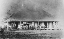
There have been cyclones that affected Marburg. According to local lore, our road became a dead-end when the big gully washed out during a cyclone in the 1890s. Previously it was the main route to Minden and points west. When it rains heavily this same gully funnels vast quantities of water off Two Tree Hill and I can imagine the road being washed away. I remember the sight of roads, bridges and even massive power pylons swept away or twisted beyond recognition by typhoons in Taiwan. According to news reports, this is a bad cyclone season. With a month or more to go, I’m hoping that the predictions are wrong.

I loved this picture on the BOM site of the historic paths taken by cyclones around Australia. It doesn’t say the time period of these but I imagine that it is a period of many years. As you can see, although cyclones tend to avoid land, there have been some major incursions. The “most squiggly” bits are right where many ships had to pass to reach Australia if the northern route was chosen. It was all a bit of a gamble for the ship, but then so was getting on a sailing ship and going to the other side of the world.

1 comment:
Oh yes, you must! It could be a wonderfully dramatic sequence in the story. Have you seen the video on the Pete Goss - Spirit of Mystery blog? Terrifying to see all that water shivering by, with no land anywhere (especially knowing how the storm turned out). And that wasn't even a cyclone!
Post a Comment